Orwell Astronomical Society (Ipswich)
Summary of Grazing Lunar Occultations for 1993
The tracks of two grazing occultations cross East Anglia during the year. Table 1 summarises the circumstances.
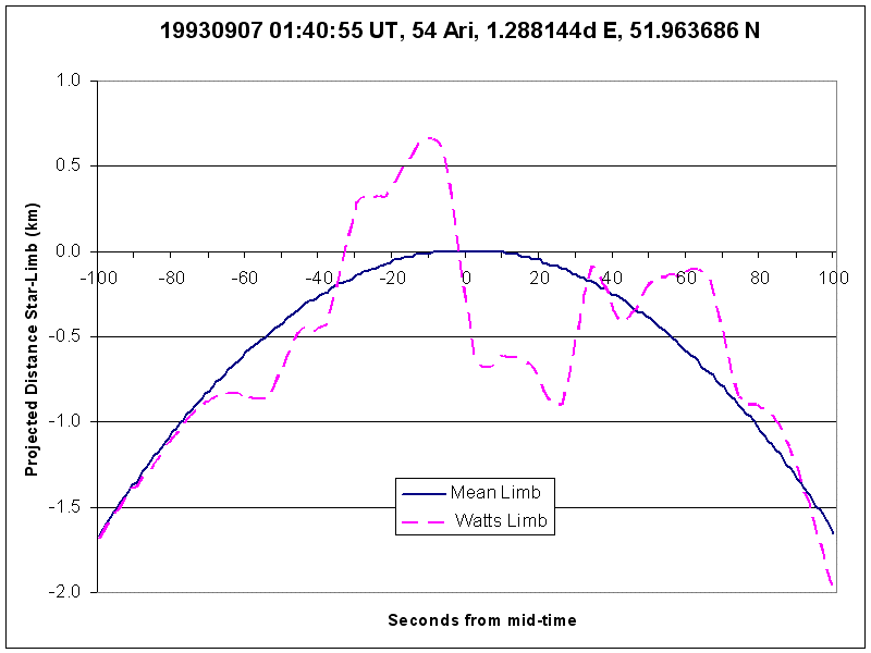
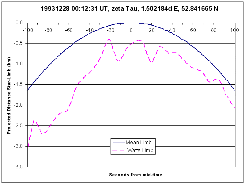
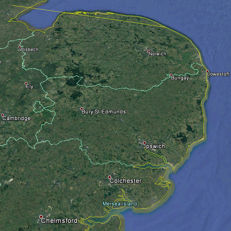
Columns one and two give the date and time of the graze and column three specifies the lunar limb involved. Column four indicates the distance between Orwell Park Observatory and point X on the track, on land, where the distance between the two is least; column five links to a plot of the lunar limb profile visible from X. Column six specifies a north or south displacement of the observer's position, relative to the track, based upon inspection of the limb profile, to maximise the chances of witnessing multiple disappearance and reappearance events. Column seven links to an on-line Google Earth plot of the track and column eight links to an off-line image of it. (The plot and image illustrate the nominal track, with no displacement applied.) Column nine details the lunar phase (positive for waxing, negative for waning) and column 10 the altitude of the Sun (a negative solar altitude means that the Sun is below the horizon). Columns 11 and 12 provide the horizontal co-ordinates of the star (azimuth in the order N→E→S→W). Columns 13 and 14 specify the star and its magnitude.
| Date 1993 |
Time (UT) |
Limb | Dist OPO (km) |
Limb Profile |
Track Shift (km) |
Google Earth Track |
Google Earth Image |
Lunar Phase |
Sun Alt (°) |
Star Alt (°) |
Star Azi (°) |
Mag | Star |
| 07 Sep | 01:41 | N | 6.4 | Profile | 0.5 S | Track | Track | 0.71- | -28 | 47 | 128 | 6.2 | 54 Ari |
| 28 Dec | 00:13 | N | 94 | Profile | 0.7 S | Track | Track | 0.99+ | -60 | 56 | 209 | 3.0 | 123 Tau, ζ Tau |
Table 1. Grazing lunar occultations.
James Appleton