Orwell Astronomical Society (Ipswich)
Geostationary Satellites, 08 October 2004 & 01-02 March 2020
A geostationary satellite travels in a circular orbit almost 36,000 km above the Earth's equator, following the direction of the Earth's rotation. It appears in a fixed position as seen from the surface of the Earth, and thus appears to move against the background stars.
From the UK, the belt of geostationary satellites appears as a stationary ring with a declination of about -7.5°: anyone who has tried to photograph the Orion Nebula may have recorded horizontal streaks through their images, as the telescope follows the nebula and the stationary satellites appear to drift by. Geostationary satellites typically have a magnitude around 12.
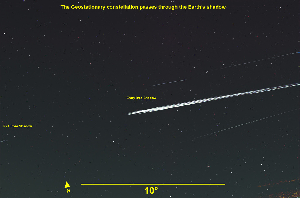
Around 01 March and 12 October each year, the Sun is also at a declination of -7.5°. If a satellite sits "upright" in its orbit, shiny body panels and solar arrays can create a spectacular reflection of the Sun. This is most pronounced just at the point where the satellite enters the Earth’s shadow (at these times of year, geostationary satellites are eclipsed by the Earth). When reflecting sunlight, the brightness of a satellite can increase considerably, up to magnitude 3, becoming potentially visible to the naked eye!
In the early evening of 01 March 2020, I took the opportunity to record the phenomenon using a Sony A7S camera with 100 mm lens on a driven but unguided mount. The entry point of satellites into the Earth’s shadow was at RA 10h 45m, declination -7.5°, among the faint star fields of Sextans.
In a two-hour period before clouds came in, I recorded 39 geostationary satellites, the vast majority in the equatorial belt with an inclination of zero. In the video below, the brightest star, λ Hydrae at magnitude 3.6, is to the bottom right. Several satellites appeared brighter, but the majority were in the range of magnitudes 5.5 to 7.0.
If satellites are the bane when photographing deep sky objects, then aircraft are the bane of wide field video photography. In the video, an aircraft would cross the field of view in six or seven frames. Approximately 6% of frames captured aircraft – they were edited out by hand.
The still photograph has a field of view sufficiently wide to capture the exit of satellites from the Earth’s shadow at RA 11h; this was an unintended bonus!
The following night, I observed again, using a longer lens, focal length 200 mm. The sky background varied throughout the three-hour observation so, rather than wrestle with that, I took a pair of frames and produced an absolute difference image. Ideally, this should contain two images of each satellite and no stars. However the stars are around the same size as the camera pixels and, depending how stars sit over the pixels, successive frames do not cancel out exactly.
I counted 66 satellites in the three-hour period, including the Astra satellites that provide satellite TV.
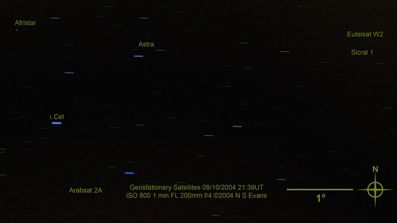
I took the following image on 08 October 2004 using a stationary (undriven) camera. It shows geostationary satellites spanning orbital slots from 16.0°E (Eutelsat W2) to 21.0°E (Afristar).
Nigel Evans